Monte Ceva Herbarium Monte Ceva Herbarium
WHERE WE FIND OURSELVES
Genesis and geological aspects of the euganean hills (colli euganei)
The Euganean Hills were raised suddenly and was isolated from other reliefs on the South Western plains of Padua; occupying an area of about 22,000 hectares, with a large elliptical perimeter of about 65 kilometres; Mount Venda, 601 meters high, pinpoints the centre and the major relief of the hill system. The landscape is characterized by rapid successions of conical profiles that dominate the soft lined relief, often interrupting the long, deep valleys.
The geological history of the Euganean Hills represents a complex episode among the various volcanic manifestations that happened in the Venetian area during the Tertiary epoch, which spanned a time frame from between 70 and 63 million years ago up until about one or two million years ago. The first eruptive activities here took place during the course of the upper Eocene (around 43 million years ago), being a type of marine volcanism manifested by underwater lava flows of basalt emitted through open fractures between the strata of sediment rock below. These lavas were very fluid and rich with gases and vapours, and expanded rapidly across the sea bed, forming extensive lava fields.
Water penetrated the conduits in the lava and the pressure of the magma gases escaped with intense explosive phases, during which a vast quantity of ash and lapilli was produced and deposited in blankets of tuff interspersed in the mud of the sea bed; we can find ample trace of these first volcanic phases in the areas of Teolo, Castelnuovo, Boccon, Vò, and on the mountains Boscalbò and Gemola. Basalt, essentially composed of calcium, makes up most of the hard rocks, is a black colour; tuff and basalt gravel are instead soft, friable calcareous rocks with a brownish colour.
After a quiet period lasting about ten million years, the Oligocene epoch (about 35 million years ago) brought a reprise in volcanic activity with the opening of new fractures that emitted types of lava more diverse than those of the first phase; acidic lava was produced in this period which was rich in silica and extremely viscous. This second phase would represent the moment of formation of the Po Valley including the definitive formation of the Hills; the landscape would then be further modelled by erosive phenomena evident in the sedimentary rocks now present. At the base position of the rocks, rhyolite comes first and is followed by trachites and latites, and layers of basalt to close the cycle.
Ryolite is composed of 70-75% silica, and can be coloured from greenish to whitish pink. Trachite has a silica content of 60-65% tinted yellowish gray and is the most noted rock of the region, where it is referred to as “masegna”. Latite, the more diffused of the three, contains 50-55% silica and is a dark grey closer to black.
Strong thrusts of viscous marble would lift and fracture the ancient strata of the sea bed; slow and massive flows went through and in part recovered the calcium and basalt deposits, producing a series of volcanic apparatuses that confer the unified aspect to the Hills. The conical ripples visible today were born of the accumulation of powerful flows out from and above the emission fissures; and thus each hill is unique in physical appearance.
EARLY HISTORY
The first traces of human activity in the Euganean Hills dates back to the Neolithic (at the turn of the eight millennium B.C.) and included findings from the slopes of Mount Madonna and Mount Venda. Around 2,000 B.C. humans began to leave traces of sedentary life near the lake of Costa di Arquà Petrarca; leading up to the Euganeans, a population of pre-Indo-European, who lived in pile-dwellings, and spent their time hunting, fishing, sheep farming, and practicing rudimental agriculture. The Euganeans were then assimilated by the Venetians, who originally coalesced in the vicinity of Mount Lozzo at the start of the Stone Age (around 1,000 B.C.). The dominion of the Venetians, a population dedicated to agriculture and bronze working, would last until the second century B.C., when Roman occupation would begin. The Romans constructed roads, gave new life to agriculture and to settlements, creating a major diffusion of the cultivation of vines, olives, and chestnuts; great developments would reach the centre of Montegrotto.
In medieval times, after the disastrous flood of 589 that deviated the course of the Adige to the south and after the descent of the Longobards, the conditions of life worsened drastically following yet a pestilence and famine; the agricultural fields were abandoned and the forest would return to occupy the ample space. Not until the year 1,000 would agricultural activity be retaken anew and better the conditions of life; in higher elevations, numerous castles arose (the castle of Valbona being one of which still remains intact), along with monasteries and hermitages, the more grandiose of those being the Benedictine abbey of Praglia founded in 1080 and the convent of Saint Daniele near AbanoTerme.
At the start of the 15th century the Euganean Hills went under the dominion of the Republic of Venice, of which the Senate would have notable works of land reclamation in expansive zones of foothills in Lozzo, Galzignano, Arquà, and others. The Hills were then valued for the construction of elegant residences for the nobility of Venice and Padua; some splendid examples include the Castle Catajo at Battaglia Terme, the Villa of the Vescovi at Luvigliano, and the Italian gardens of the Villa Barbarigo at Valsanzibio.
With Napoleon’s entrance into Venice and the fall of the Serenissima in 1797 this period of wellbeing was terminated, to be followed in the eighteen-hundreds by an era of intense overgrowth of the forests for the production of lumber. The last century was characterized by the uncontrolled expansion of extraction activity, which provoked profound alterations on the territory that would be semi-permanent; in the 1970’s and 80’s the state would decree that the Venetian region would make the norm that would regulate extraction activity, limiting the extraction of precious cuts of trachite and materials for cement and calcium. In 1989 the Regional Park of the Euganean Hills was instituted completely as a work of safeguarding. In regards to the economy of the zone, since the 1950’s there developed a quality of vine culturing, the products of which are valued at the Wine Consortium D.O.C.; in the last few years there has been a diffused practice of agro-tourism, which supports the succession of the restoration of Euganean traditions.
THERMAL-ISM
Among the particular characteristics of the Euganean Hills the phenomenon of thermal-ism occupies an important place, particularly present in the areas of Abano, Montegrotto, Battaglia, and Galzignano. The thermal sources, known and appreciated for their therapeutic properties since Roman times, gushing from innumerable and spontaneous sources, but since the beginning of the 1900’s increasing requirements for the need of thermal stabilization has requested for the perforation of wells always deeper; in actuality there are about 200 wells.
Up until a few years ago it has been kept that the origin of thermal-ism was attached to the same volcanic origins as the Hills, but recent studies have cleared away this aspect, proposing instead a model geothermal circuit, independent of the volcanism that generated the Hills, which is too ancient anyhow to still constitute the active heat source. According to this model, the feeding zone of the circuit could be individualized in the Prelapi Vicentine, where rainwater descends to a depth of around 3,000 meters thanks to the permeability of the rocks; the presence of a crystalline basement formed from impermeable rocks, is a natural method of irrigation. During the descent, the normal internal heat of the earth constantly raises the temperature of the water; furthermore, during its time underground – which for the territorial organization happens from the north-east to the south-east – the water takes on a certain radioactivity and is charges with various salts and some of the more soluble minerals, and when the water arrives at the surface the salinity is proportional to the temperature.
After running a course of hundreds of kilometres that takes about 25 years the water finds its principal exit in the Euganean area due to the favourable structural situation. The rocky masses that protrude the surface of the territory reach in fact to the bottom of the crystalline basement and are deeply fissured in a way that they absorb a great quantity of the compressed meteoric water from beneath, drinking from a great depth and favouring re-emergence along the flanks of hill groups. The temperature of the thermal sources vary between 17°C and 58°C, while that of the water taken from wells is between 60°C and 87°C; the most common chemical substances present in the water are sodium, potassium, calcium, magnesium, chlorine, sulphur, carbon, silica, and boron. Thermal water is fundamental for the preparation of vegetal-mineral mud baths, obtained from the spontaneous mineralization of microscopic particles of algae in appropriate tubs; such mud is an elemental curative characteristic to the thermal basin.
CLIMATE
Principal characteristics of the Euganean climate are an annual median temperature of 13°C with modest rain. In general the Euganean climate is mild, with minor daily excursion in respect to the plains; in winter times on the plains the thermometer goes below zero more often and for longer periods. This explains how olives, cypress, laurel, broom, and other exponents of Mediterranean flora lived under the Euganeans. The summer climate on the hills was cooler and less muggy than that on the plains. Such climatic variations influenced the morphology of the relief, from the exposure and the incline of the hillside; as such the same hill could have various microclimates, and then environmental conditions, thusly diversified, could support Mediterranean at noon and at other times that of sloping hills or mountain.
VEGETATION
The Euganean Hills represent a complex naturalistic isolation, where tightly packed vegetation thrives in a hot and dry environment (thermophiles) as well as mountain or sub-mountain vegetation (micro thermals); such floral variety is possible with the diverse origins and chemical compositions of the soil, the particular morphology of the relief, the isolation from other mountain ranges, and the alternate climatic events tied to the glacial cycles and to the post-glacial period. Notwithstanding the changes carried out by human actions, we can subdivide the Euganean flora into the following vegetal associations:
CHESTNUT FOREST
Extensive on the Hills, this terrain is developed on the volcanic sides turning with preference to the north. The forest floor is made of relatively moist soil rich in silica and teems with numerous species of grasses and early flowerers including snowdrop, hound’s-tooth, daffodil, blackberry, and the rare lilies martagone and San Giovanni. Only in recent times has the cultivation of the chestnut been noticeably reduced due to changes in social conditions and for the destruction brought by tree bark cancer.
MEDITERRANEAN PATCH
This is formed by an intricate vegetation of low-stemmed plants, evergreens in general, including helm oak, elder, and violets; it develops on isolated, arid, and rocky volcanic terrain facing southward. Plants growing in the Mediterranean patch also include the dwarf Indian fig and the miniature cactus, originating from Central America and naturalized in other isolated rocky areas such as Mount Ceva at Battaglia.
OAK FOREST
This growth occupies the slopes exposed at noon, on well-heated and dry terrain with shallow soil and of calcareous preference. There is a mixed undergrowth, where the dominant acorn trees grow side by side with the black Carpathian, the orniello, and the bagolaro. Undergrowth companions include the pungitopo, hawthorn, and juniper. In actuality this zone is infrequent and agriculture does not adapt well to it.
MEADOW
The meadows, typically arid and sometimes devoid of soil, are derived from the adaptation of cultivation and pastures of lesser production (vegro); herbaceous species fond of dryness dominate, mostly mixed grasses in nature leguminous and spiny. Hawthorn, spotted rose, and juniper can be found growing on terrain that has been abandoned for long amounts of time, which prepare the soil for the arrival of the dwarf oak, black Carpathian, and the orniello. Orchids of bizarre form occasionally appear, such as the butterfly orchid, the monkey orchid, and the bearded orchid.
ACACIA UNDERGROWTH
Originally from North America, the acacia was imported at the start of the 1600’s as an ornamental species, but excessive spread of forests and the abandonment of cultivation have given the plant a chance to diffuse at the expense of young chestnut and oak trees. Acacia undergrowth is rather monotonous with few other arboreal plants and little in the way of bushes which include the elder and the rovi. The undergrowth is made up of white and purple anemones.
MOUNT CEVA
The mountains Ceva – Spinefrasse are part of a group of hills, of variegated nature, running between Battaglia Terme and Montegrotto Terme. The most interesting aspect of the mountain group Ceva-Spinefrasse is tied to their particular constituencies; the group was in fact formed from a potent accumulation of latitic rubble superimposed on a bank of tuff and rhyolitic rubble. The rubbles were constituted of angular fragments of volcanic rocks, of variable dimensions from less than one millimetre up to one or two meters, absorbed by a matrix of its own nature.
At the very peak of mount Ceva, at a certain point, holding a compass to the rocks, you can see a marked deviation in the compass needle to the point of inversion. This phenomenon is attributed to the presence of ferromagnetic minerals (magnetite) permeated into the latitic rubble, which present a residual magnetic field acquired during volcanic formation and since rotated in respect to the actual earthly magnetic field.
Mount Ceva (255 m) marks the north end of the plain called “Ferro di Cavallo” (horse iron). Not far in the south-east direction, we find mount Cevona, of the same altitude and a bit wider in respect to the other peak. In local dialect, the name of the mountain is Sieva, which is probably derived from the saepes hedge, in the sense of the mountain cut up in deforestation.
|
|
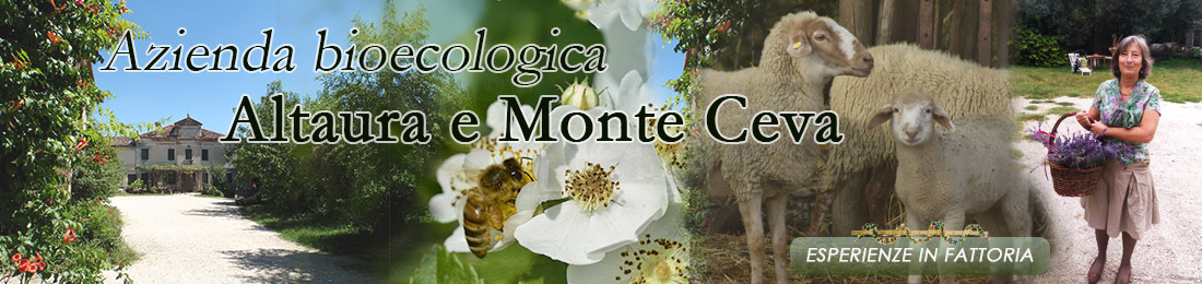
 EDUCATIONAL FARM